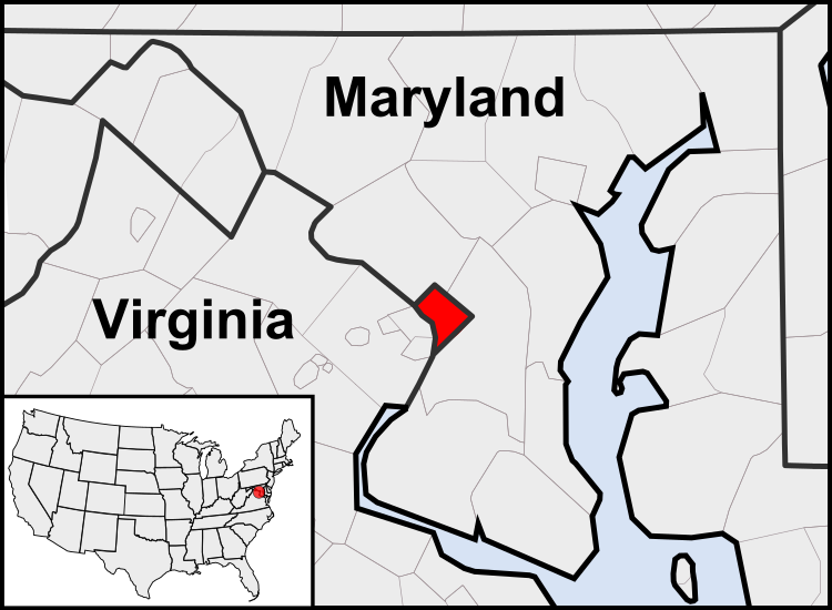
Figura:Washington, D.C. locator map.svg

Dimension ëd costa anteprima PNG dë st'archivi SVG: 750 × 550 pontin. Àutre arzolussion: 320 × 235 pontin | 640 × 469 pontin | 1 024 × 751 pontin | 1 280 × 939 pontin | 2 560 × 1 877 pontin.
Archivi original (archivi an forma SVG, amzure nominaj 750 × 550 pontin, amzura dl'archivi: 160 KByte)
Stòria dl'archivi
Ch'a-i daga un colp col rat ant sna cobia data/ora për ës-ciairé coma a restèissa l'archivi ant col moment-là.
| Data e Ora | Miniadura | Amzure | Utent | Coment | |
|---|---|---|---|---|---|
| dël dì d'ancheuj | 05:23, 23 Luj 2011 |  | 750 × 550 (160 KByte) | Patrickneil | Reverted to version as of 03:04, 23 July 2011 |
| 05:21, 23 Luj 2011 |  | 750 × 550 (161 KByte) | Patrickneil | Reverted to version as of 03:14, 23 July 2011 | |
| 05:20, 23 Luj 2011 |  | 750 × 550 (161 KByte) | Patrickneil | frame | |
| 05:14, 23 Luj 2011 |  | 750 × 550 (161 KByte) | Patrickneil | thicker frame | |
| 05:04, 23 Luj 2011 |  | 750 × 550 (160 KByte) | Patrickneil | straightening Maryland and Delaware borders | |
| 04:09, 15 Aos 2010 |  | 750 × 550 (202 KByte) | Patrickneil | Delaware River again | |
| 03:51, 15 Aos 2010 |  | 750 × 550 (274 KByte) | Patrickneil | Delaware River border | |
| 03:42, 15 Aos 2010 |  | 750 × 550 (273 KByte) | Patrickneil | forgot border on Smith Island | |
| 03:34, 15 Aos 2010 |  | 750 × 550 (273 KByte) | Patrickneil | county borders below state | |
| 03:32, 15 Aos 2010 |  | 750 × 550 (274 KByte) | Patrickneil | changes by request |
Anliure a le figure
A-i é pa gnun-a pàgina che a dòvra sto archivi.
Dovragi global dël file
J'àutre wiki sì sota a deuvro st'archivi-sì:
- Usagi dzora af.wikipedia.org
- Usagi dzora an.wikipedia.org
- Usagi dzora ar.wikipedia.org
- Usagi dzora arz.wikipedia.org
- Usagi dzora as.wikipedia.org
- Usagi dzora azb.wikipedia.org
- Usagi dzora bh.wikipedia.org
- Usagi dzora bs.wikipedia.org
- Usagi dzora ceb.wikipedia.org
- Usagi dzora ckb.wikipedia.org
- Usagi dzora en.wikipedia.org
- Usagi dzora en.wikinews.org
- Usagi dzora es.wikipedia.org
- Usagi dzora es.wiktionary.org
- Usagi dzora et.wikipedia.org
- Usagi dzora fr.wikipedia.org
- Usagi dzora fr.wiktionary.org
- Usagi dzora fy.wikipedia.org
- Usagi dzora gv.wikipedia.org
- Usagi dzora hu.wikipedia.org
- Usagi dzora ia.wikipedia.org
- Usagi dzora id.wikipedia.org
- Usagi dzora ilo.wikipedia.org
- Umuna a Panid
- Washington, D.C.
- Wikipedia:Ammom kadi/2013
- Plantilia:Ammom kadi/Agosto 3
- Plantilia:Ammom kadi/Septiembre 22
- Plantilia:Ammom kadi/Nobiembre 11
- Plantilia:Ammom kadi/Disiembre 31
- Plantilia:Ammom kadi/Enero 16
- Plantilia:Ammom kadi/Marso 6
- Plantilia:Ammom kadi/Abril 25
- Plantilia:Ammom kadi/Hunio 14
- Wikipedia:Nasalakniban-sariap a bambanag/Umuna a Panid/2
- Usagi dzora incubator.wikimedia.org
- Usagi dzora it.wikipedia.org
- Usagi dzora jam.wikipedia.org
- Usagi dzora ja.wikipedia.org
- Usagi dzora jbo.wikipedia.org
- Usagi dzora ko.wikipedia.org
- Usagi dzora lb.wikipedia.org
- Usagi dzora lfn.wikipedia.org
Varda l'usagi global dë st'archivi-sì.
