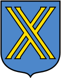
Castrop-Rauxel
Aspetto
| Castrop-Rauxel | |
|---|---|
 Vista ëd Castrop-Rauxel | |
| Scu | Mapa |

|
|
| Aministrassion | |
| Paìs | |
| Stat | Nòrd Ren-Westfalia |
| Region aministrativa | Münster |
| Distret | Recklinghausen |
| Prefet | Johannes Beisenherz |
| Partì al govern | SPD |
| Statìstica | |
| Coordinà geogràfiche | |
| Aira | 51,66 km² |
| Autitùdin | 98 m |
| Popolassion | 76.876 (31/12/2007) |
| Densità ëd popolassion | 1.488 ab./km² |
| Autre Informassion | |
| Targa automobilìstica | RE |
| Còdes postal | 44575-44581 |
| Còdes telefònich | 02305 02367 (Henrichenburg) |
| Adrëssa dla prefetura | Europaplatz 1 44575 Castrop-Rauxel |
| Localisassion ëd Castrop-Rauxel ant ël distret ëd Recklinghausen | |
 | |
Castrop-Rauxel a l'é na sità dl'Almagna, localisà ant ël distret ëd Recklinghausen, region aministrativa ëd Münster, stat ëd Nòrd Ren-Westfalia.[1][2]

