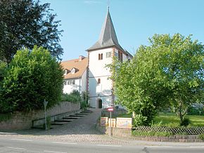
Höchst im Odenwald
Aspetto
| Höchst im Odenwald | |
|---|---|
 | |
| Scu | Mapa |

|
|
| Aministrassion | |
| Paìs | |
| Stat | Assia |
| Region aministrativa | Darmstadt |
| Distret | Odenwaldkreis |
| Statìstica | |
| Coordinà geogràfiche | |
| Aira | 30.51 km² |
| Popolassion | 10199 (2019) |
| Densità ëd popolassion | ab./km² |
| Autre Informassion | |
Höchst im Odenwald a l'é un munissipi dl'Almagna, situà ant ël distret ëd Odenwaldkreis,ant lë stat ëd l'Assia. A l'ha 30.51 km² d'aira, e soa popolassion dël 2019 a l'era stimà 10.199 abitant.[1]

